Exploring the unseen beauty of Kashmir: A drive along the LoC
Tourism booms the economy, but it should not be at the cost of the environment. Many of the Kashmir’s popular tourist spots are currently grappling with overcrowding and experiencing a surge in litter due to the sheer volume of tourists.
BHPian ruzbehxyz recently shared this with other enthusiasts.
This travelogue is dedicated to the Indian Armed Forces deployed in the Union territories of Jammu and Kashmir, & Ladakh. Special thanks to the Indian Army who hosted us at many places and for providing us special permission to drive through some areas normally out of bound for civilians. We are truly indebted to them.

A photograph taken by an astronaut aboard the International Space Station.
This photograph shows one of the few places on Earth where an international boundary can be seen at night. The winding border between India & Pakistan is lit by security lights that have a distinct orange tone.
Source
Come 1960’s, the Indian Film industry played a major role in boosting tourism in Kashmir. A spate of Bollywood movies, like Junglee (1961), Kashmir ki Kali (1964), Jaanwar (1965), Jab Jab Phool Khile (1965), Bobby (1973), Kabhie Kabhie (1975), Aap ki Kasam (1974), Noorie (1979), Silsila (1981) and Betaab (1983) captured the true essence of Kashmir. These movies were shot all around Kashmir valley mainly at Srinagar, Pahalgam, Gulmarg, Sonamarg, Dal Lake, Shalimar Gardens, Betaab valley etc., which led to Kashmir being a favourite among Indian travelers. In fact, Betaab valley was named after the 1983 Sunny Deol starrer Betaab which was shot in the Hajan valley. Another instant is the Gulmarg hut in which the famous song ‘Hum tum ek kamray main baand…’ of Rishi Kapoor’s debut film ‘Bobby’ was shot, which became famous as the ‘Bobby Hut’.
Kashmir was also the favored honeymoon destination for many young couples, expressing their love in the same way Shammi Kapoor romanced his heroines on the houseboats and shikaras of Dal Lake or in the lush green forests of the valley. This was boom time for tourism in Kashmir. In 1987, according to a government survey, 7 lakh tourists visited Kashmir. Three years later, the number fell to just 6,000.
In 1988-89, insurgency and later militancy & terrorism erupted in the Kashmir Valley. Thanks to the efforts of our neighbouring country. Then the Indian Armed Forces moved in to counter the insurgency, resulting in a cross-border and internal conflict which has claimed the lives of thousands of locals and military personnel. With the Armed Forces entering the valley, eventually turned the land, often called “Heaven on earth” into the world’s most militarised zone, with a ratio of one Indian soldier to every ten civilians.
Today as we speak about tourism in Kashmir, only few places come to our mind – Srinagar, Gulmarg, Sonmarg and Pahalgam. However there’s lot more to Kashmir. Ditching the regular tourist spots, we headed into areas which are sensitive and near the Line of Control. These places were not explored mainly because of terrorism and insurgency across the valley and hence kept out of bounds for civilians. There are many places which will leave you mesmerised. Each place has its own distinct charm and each valley has its own beauty.
There’s much more to these heavenly locations, which has lost its sheen in the labyrinth of politics, terrorism and social unrest. Still in these testing times, the nature has survived and retained its natural exquisiteness.
Date of travel: 06th Oct. to 19th Oct. 2023.
Route:- Delhi – Panipat – Kurukshetra – Ambala – Ludhiana – Jalandhar – Pathankot – Jammu – Akhnoor – Bhimber Gali – Poonch – Chakan da baug (LoC) – Mughal road – Peer ki Gali – Shopian – Pulwama – Tangmarg – Uri – Kaman bridge (LoC) – Baramulla – Reshawari – Bangus valley – Teepee – Sadhna top – Teetwal – Ragini sector – Pharkiyan Gali – Keran (LoC) – Kupwara – Zamindar Khan Gali – Machil valley – Dudi – Kalaroos – Lolab valley – Kupwara bypass – Wular lake (western side) – Bandipora – Razdan pass – Gurez valley – Dawar – Niru – Chakwali – Bandipora – Wular lake (eastern side) – Srinagar – Ramban – Jammu – Pathankot – Delhi.
Index: –
- Introduction
- The formation of the LoC and the division of Jammu & Kashmir
- Akhnoor
- Poonch area & Chakan da bagh on the LoC
- Mughal road & Peer ki gali
- Uri & Kaman bridge on the LoC
- Bangus valley
- Tut Mari Gali / TMG
- Sadhna Pass, Karnah valley & Teetwal on the LoC
- Pharkiyan Gali & Keran village on the LoC
- Zamindar Gali & Machil valley
- Kalaroos caves & Lolab valley
- Razdaan Pass
- Gurez & Tulail valley
- The Permit system
- Conclusion
Highlights:-
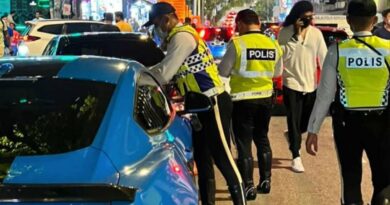
1. Apart from the regular online permits, we were assisted by the Indian Army for permissions of various places.
2. We stayed at various Army mess’ in some areas, names of which are not given here.
3. We have not taken photos of any Army installations etc. Some photos were taken with permission.
4. These areas were notorious for terrorists and militants at one point of time. Hence security is a big issue.
5. These are the four major places visited right on the LoC – Chakan Da Bagh, Kaman bridge, Teetwal and Keran.
6. For each valley you need to cross a pass – Eg. Sadhna top / NC pass for Teetwal, Pharkiyan Gali for Keran, Zamindar Gali for Machil, Razdan top for Gurez.
7. Pass is locally called “Gali” in Kashmir. The Army and locals use shortcuts for the passes. eg. NC pass for Sadhna pass, P Gali for Pharkiyan Gali, Z Gali for Zamindar Gali.
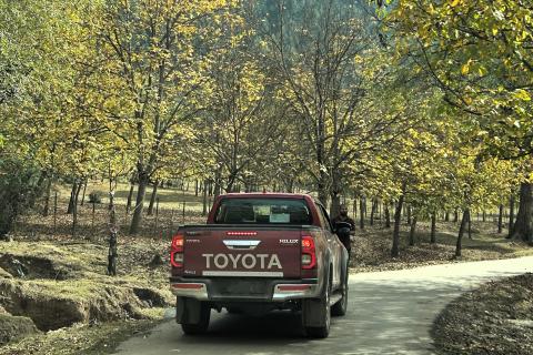
8. We made this trip in October which is Autumn. The greenary had slowly turned golden and it was truly a wonderful sight to see.
9. This area is still raw and lot of infrastructure is coming up for tourism.
The formation of the LoC and the division of Jammu & Kashmir:
This is a very vast topic and out of the scope of discussion here. Hence I will explain in brief with some diagrams.

Source: Indian Defence review.
When British India gained Independence in 1947, two separate nations were created – India & Pakistan. However Maharaja Hari Singh, the ruler of the princely state of Jammu & Kashmir decided to remain Independent. In October the same year, the Maharaja faced a rebellion from the locals in Poonch, in favour of Pakistan. Taking advantage of this, Pakistan started arming the rebels and began invading Kashmir under Code name ‘Operation Gulmarg’. The Maharaja then appealed to the Indian government to send troops and sought desperate help. It was Lord Mountbatten who said to the Indian rulers that it was improper for the Indians to send their troops to Kashmir, until such time that the Maharaja accedes to India. This was readily agreed by the then PM Jawaharlal Nehru and his ministers. Finally the Maharaja signed the Instrument of Accession on 26th Oct. 1947. The very next day, an Infantry Battalion was flown to Srinagar using many civilian and Air Force aircrafts, as in those days the Jammu- Srinagar road was just a track.
Then on 31st Dec. 1947, India approached the UN Security council to resolve the Kashmir issue. The Security Council established a UN Commission (United Nations Commission for India and Pakistan — UNCIP). After negotiations with the two sides, the Commission passed a resolution in August 1948. The resolution dealt with ceasefire, terms for truce, and procedures for negotiation regarding the plebiscite. Both the countries accepted the resolution and a ceasefire was achieved on 31 December 1948. Finally the Karachi Agreement was signed in 1949 by the military representatives of both countries, thus establishing a Cease-Fire Line (CFL), most of which became the LoC in 1972.
In Aug. 1965, Pakistan launched ‘Operation Gibraltar’ which eventually led to the 2nd Indo-Pak war. This war caused thousands of casualties on both sides and witnessed the largest engagement of armored vehicles and the largest tank battle since World War II. Hostilities between the two countries ended after a ceasefire was declared through UNSC Resolution following a diplomatic intervention by the Soviet Union and the United States.
The 1971 war which was the 3rd Indo-Pak War was an armed conflict between India and Pakistan that occurred during the Bangladesh Liberation War in East Pakistan from 3 December 1971 to 16 December 1971. During this war, Pakistan opened the Western front in Kashmir. Some areas were taken by India. The ceasefire subsequently led to the Shimla agreement in 1972. The Line of control (LoC) came into existence from the Shimla agreement signed between India and Pakistan on 02nd July 1972. Both nations agreed to rename the ceasefire line as the “Line of Control” and pledged to respect it without prejudice to their respective positions. Hence the LoC is a military control line — a line which does not constitute a legally recognized international boundary, but serves as the de facto border. Apart from minor details, the line is roughly the same as the original 1949 cease-fire line.
Though it is conveniently called a line, on the ground it breaks all the laws of linearity. It follows no regular principles, such as, watershed in the mountains, defined natural features in the plains, or river edges. The meandering, and at places militarily illogical, LoC moves mindlessly on mountain spurs with a few high and low posts held by opposing sides on a single mountain. It is not uncommon to find an Indian post in a depression surrounded by Pakistani ones on a high ground and vice-versa. Some posts are as close as 100 metres of each other. Apart from causing geographical divisions, such as, mountains, farmlands and rivers, the LoC has divided families, with one half living across the line which has known no control ever since it came into being.
Given the unbridled nature of the LoC, those who are bound by duty to keep vigil at the treacherous forward posts prefer to keep their heads down. Any uncalculated move has the potential of getting punished by the enemy fire, especially on ranges where some posts are so close to one another that on a good day the foes get into a friendly banter.
Source
The Division of the erstwhile state of Jammu & Kashmir:

Source: Created by the US Central Intelligence Agency and hosted by the University of Texas-Austin Perry-Castañeda Library Map Collection.
The former princely state of Jammu & Kashmir is divided into various parts, all of which are rightfully claimed by India.
1. Union territories of ‘Jammu and Kashmir’ and ‘Ladakh’: These territories were under India since Independence in 1947. Formerly the Union territories were called Jammu & Kashmir state till 2019, prior to abrogation of Article 370.
2. PoK: India calls the territory occupied by Pakistan as PoK or Pakistan occupied Kashmir, while Pakistan calls it as Azad Kashmir. They even have a separate flag for it. This area borders Pakistan’s Punjab area to the South and Kyber Pakhtunwala province to the west. PoK also includes some border areas of old Kashmir, mostly centered around the Neelam valley. To the East, PoK is separated by the LoC with India. The capital of PoK is Muzaffarabad while Mirpur is the largest city.
3. Gilgit-Baltistan: Formerly called as Northern Areas, remained an amorphous entity for many decades. This area is under Pakistan. It borders PoK to the south, Khyber Pakhtunwala to the west, Wakhan corridor of Afghanistan to the north, Xinjiang region of Tibet to the east and Ladakh to the South-east. This area was taken by Pakistan in 1947-48. After the Karachi agreement of 1949, this area came under direct control of Pakistan. However the region did not find mention in the Constitution of Pakistan. Gilgit is the capital of this region, while Skardu is the largest city.
4. Trans-Karakoram tract or Shaksgam tract: This area was transferred to China by Pakistan in 1963 according to the agreement between the two countries. Although the Shaksgam tract was never under the control of Pakistan since 1947, in the 1963 Agreement, Pakistan recognized Chinese sovereignty over the Shaksgam tract, while China recognized Pakistani sovereignty over the Gilgit-Baltistan area, and a border based on actual ground positions was recognized as the international border by China and Pakistan.
5. Siachen glacier area: The northernmost point of the Line of Control is known as NJ9842, beyond which lies the Siachen Glacier, which became a bone of contention in 1984. India holds favourable positions in the glacier. The conflict led to a new line which is called AGPL (Actual Ground Position Line). Siachen is the highest battlefield in the most world, with Bana top being the highest outpost at 20,500 feet. The 1949 Karachi Agreement and 1972 Simla Agreement did not clearly mention who controlled the glacier, merely stating that the cease-fire Line terminated at NJ9842. UN officials presumed there would be no dispute between India and Pakistan over such a cold and barren region.
6. Aksai-Chin area: Aksai Chin area is largely a vast high-altitude desert bordering Ladakh. In the southwest, mountains up to 7,000 m. extending southeast from the Depsang Plains form the de facto border or LAC (Line of Actual Control) between Aksai Chin and Ladakh. Despite this region being nearly uninhabitable and having no resources, it remains strategically important for China as it connects Tibet and Xinjiang. In 1951-57, China built a road connecting Xinjiang and western Tibet, of which 179 km. ran south of the Johnson Line through the Aksai-Chin region claimed by India. Aksai-Chin was easily accessible to the Chinese but was more difficult for the Indians to reach due to steep mountains. The Indians did not learn of the existence of the road until 1957, which was confirmed when the road was shown in Chinese maps published in 1958. The construction of this highway was one of the triggers for the Sino-Indian War of 1962.
Out of the total area of Jammu and Kashmir (2,22,236 sq. km), about 35 per cent (78,114 sq. km) is under illegal occupation by Pakistan, and about 2 per cent (5,180 sq. km) has been handed over by it to China, which is already in illegal occupation of an additional 17 per cent in the Aksai-Chin area (37,555 sq. km). The total area of PoK excluding Gilgit-Baltistan is about 13,297 sq. km. This implies that India controls about 46 per cent (1.01 lakh sq. km) of the erstwhile state of J&K. Out of this area, about 26 per cent forms part of the Jammu division, 16 per cent the Kashmir division and the remaining 58 per cent the Ladakh-Kargil division. But the proportional distribution of the population in these divisions is 43 per cent in Jammu, 55 per cent in Kashmir and 2 per cent in Ladakh. India controls 46 per cent of the land area and 61 per cent of its population. Pakistan controls 35 per cent of the land while China controls the remaining 19 per cent including the Shaksgam Valley area.
Source: Read Full Article